Kilkenny Ridge Trail
Written on July 9th, 2018 by Paul Beaudet
I’ve been thinking about this particular backpacking adventure since late last year. So I added up the book time and figure we could plant a car at the Starr King trailhead and move south bound through the range. Book time was 17.5 hours for the ridge. Which looking over our stats is probably accurate in ideal conditions with day packs.
The trail for us started at South Pond. At the north end of the trail. The recreation park is only open 10am-8pm. We parked outside the gates and road walked into the park to get to the trailhead.
Not too far down the Ridge Trail is the side path down into the Devil’s Hopyard. At this point in the trip we thought time was on our side to might as well hop around with the devil.
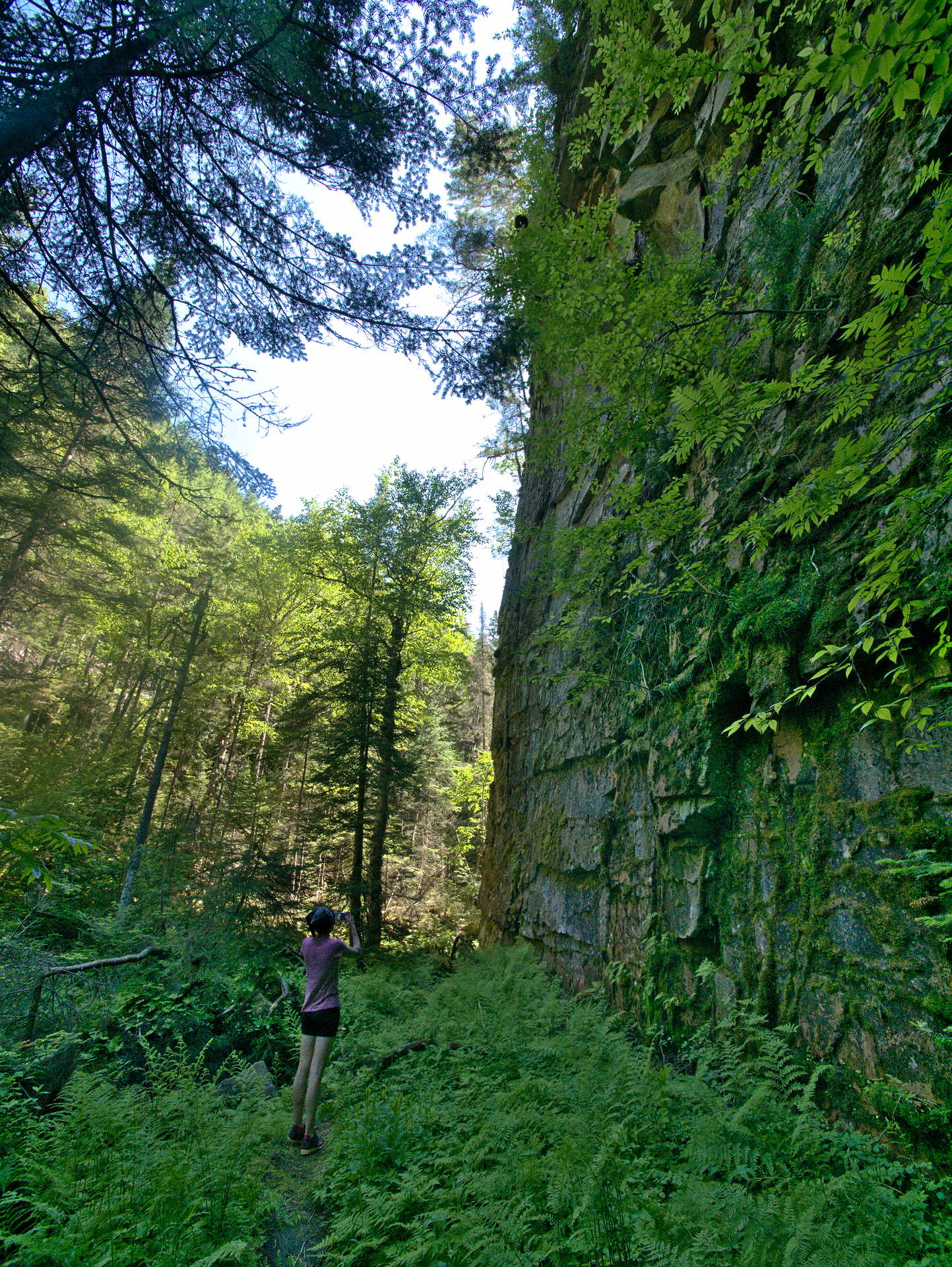
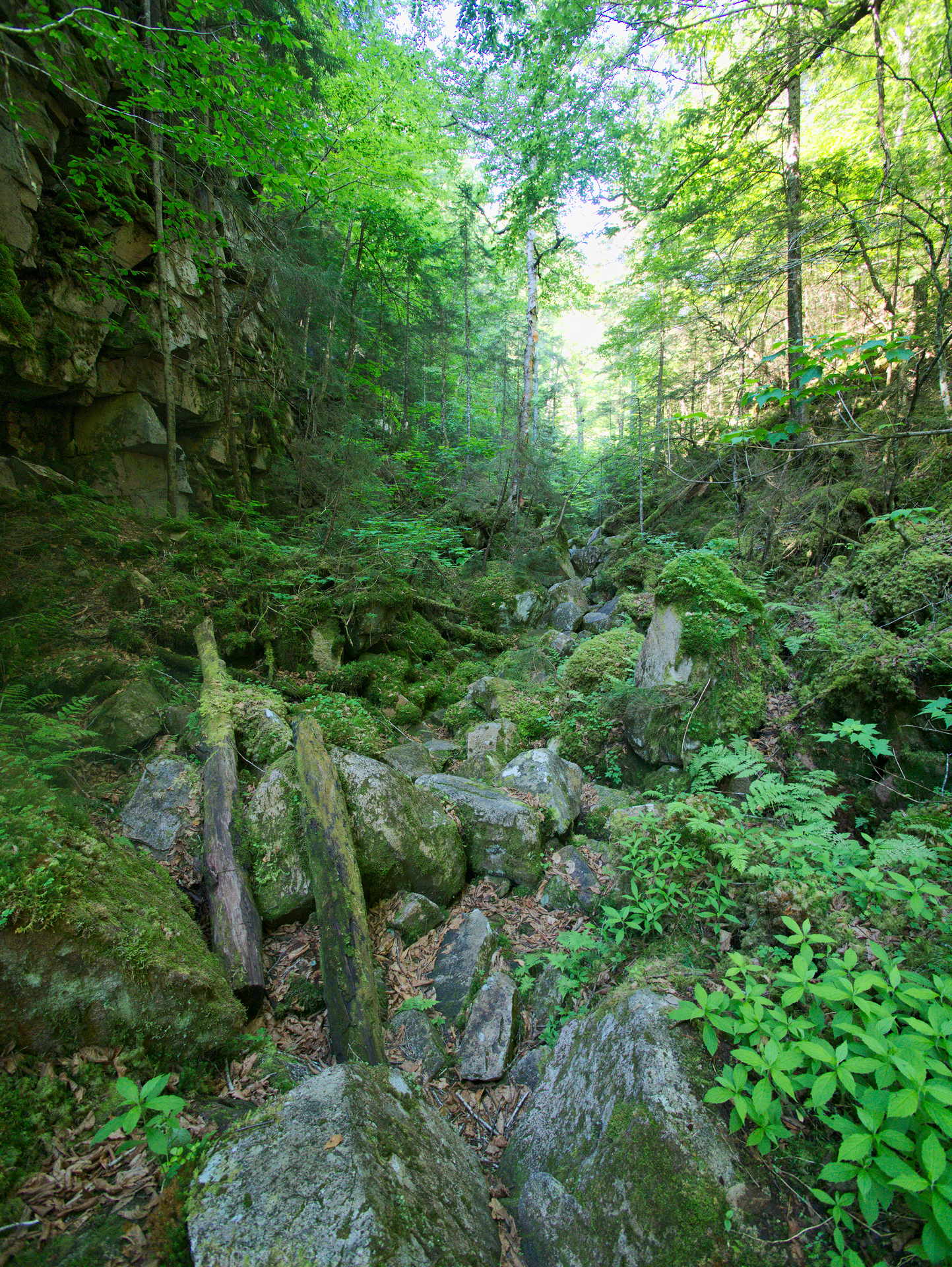
The Hopyard trail cuts through the base of a box canyon. The moss and the ferns give it a fairy tail like character. A brook runs 6-9 feet beneath the rocks and boulders in some place by the sound of it. The trail ends non-ceremoniously at a sign that says “end of trail”. Trust me you can climb that rock, not worth it, the trail is done.
The trail is pretty rough in some of the lesser traveled areas on the way to Roger’s Ledge and Unknown Pond. There were occasional blow downs and climbing with larger packs wore on us a bit. Would have a picture from the top of Roger’s Ledge here but I was too busy realizing that book time was going to be wrong.
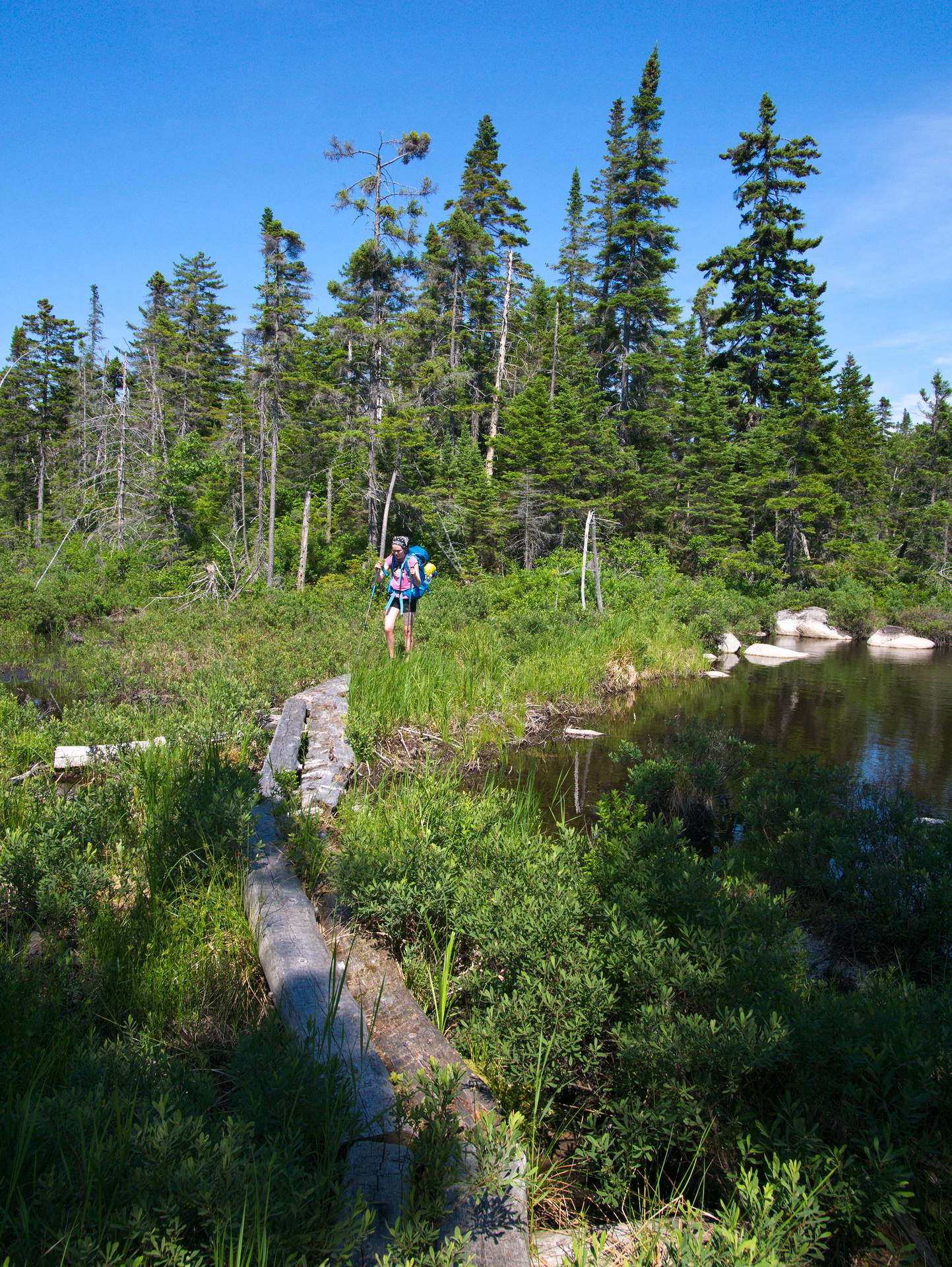
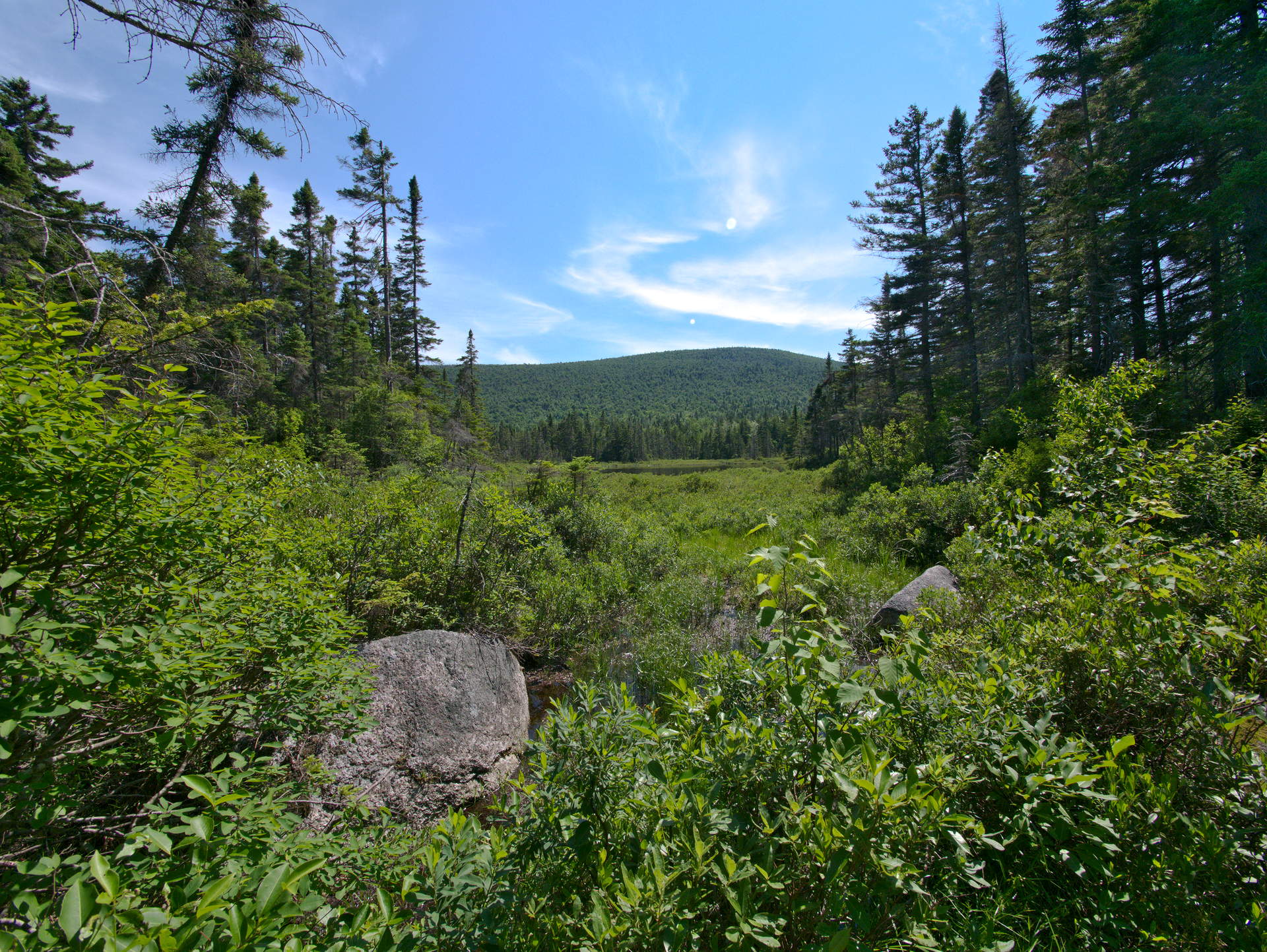
Before getting to Unknown Pone there is a maybe lesser known unnamed pond. Some of the bridge planks are breaking down into the water, but it’s still okay to pass.
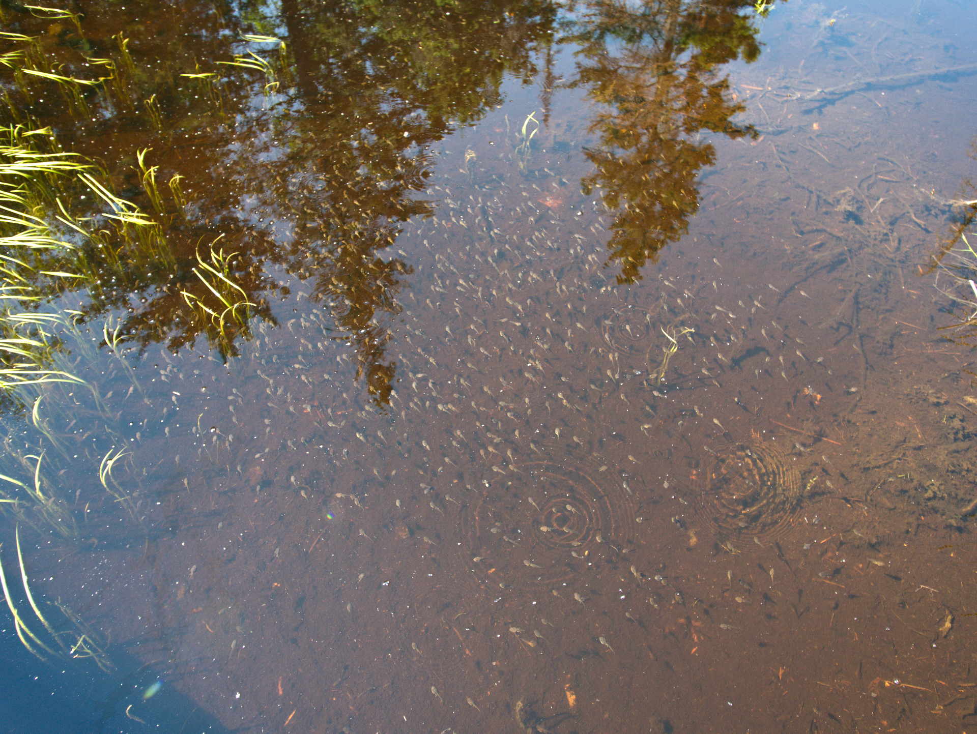
The pond was teeming with pollywogs.
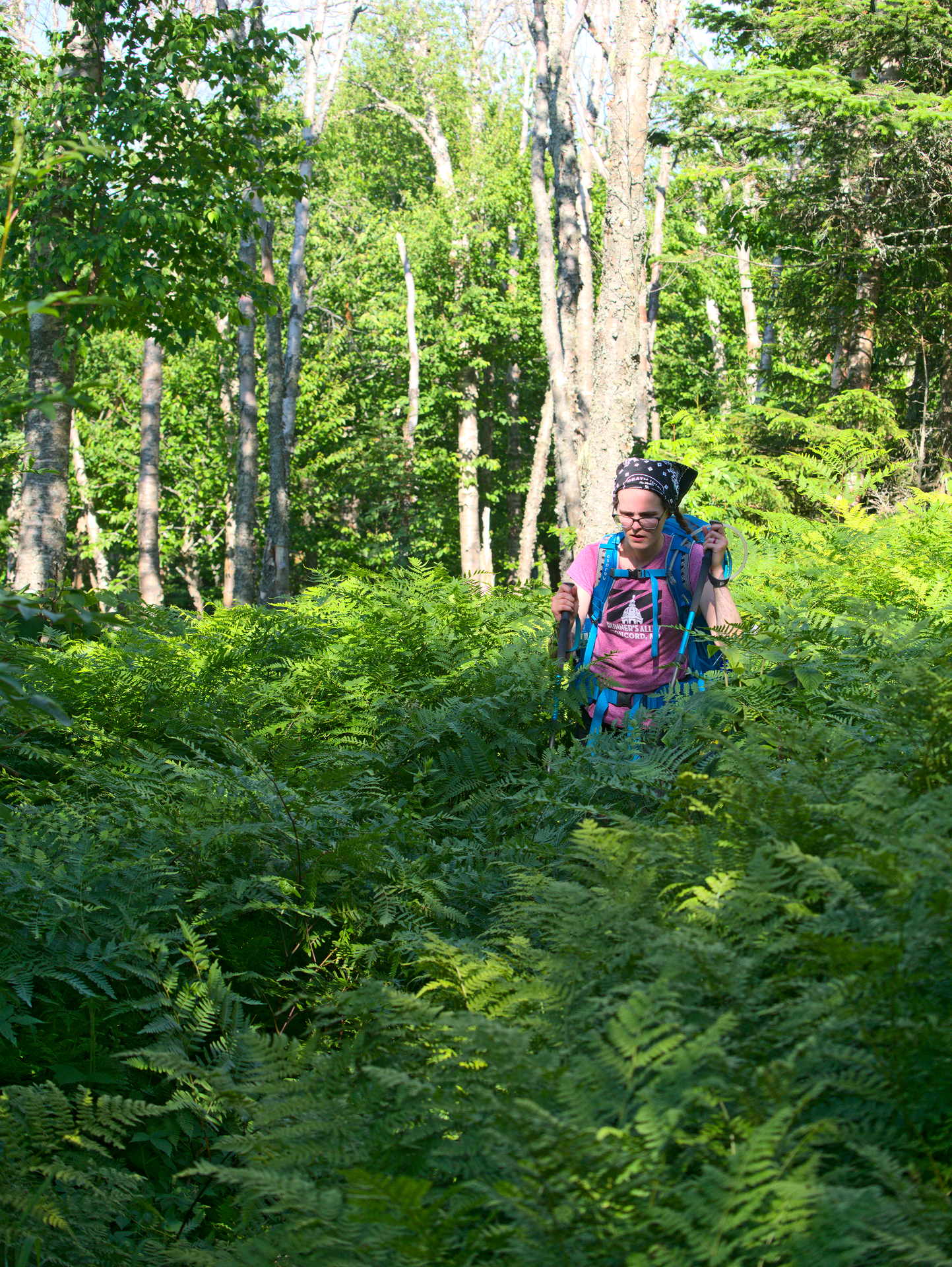
Of the 20+ miles of trail we encountered overgrown trails about 15% of the time. Personally I found the trail easy to follow despite this. There is supposed to be an ultra marathon on the Ridge Trail coming up. Makes me a bit uneasy that folks might not know what they are getting into. I guess if you have sensitive legs wear pants? Though maybe if you have sensitive legs you shouldn’t try to run an ultra marathon through rough wilderness. Surprisingly we found no ticks on us, maybe it’s out of season or maybe since it was just hard enough for the skin to stay on the tick had the same issue.
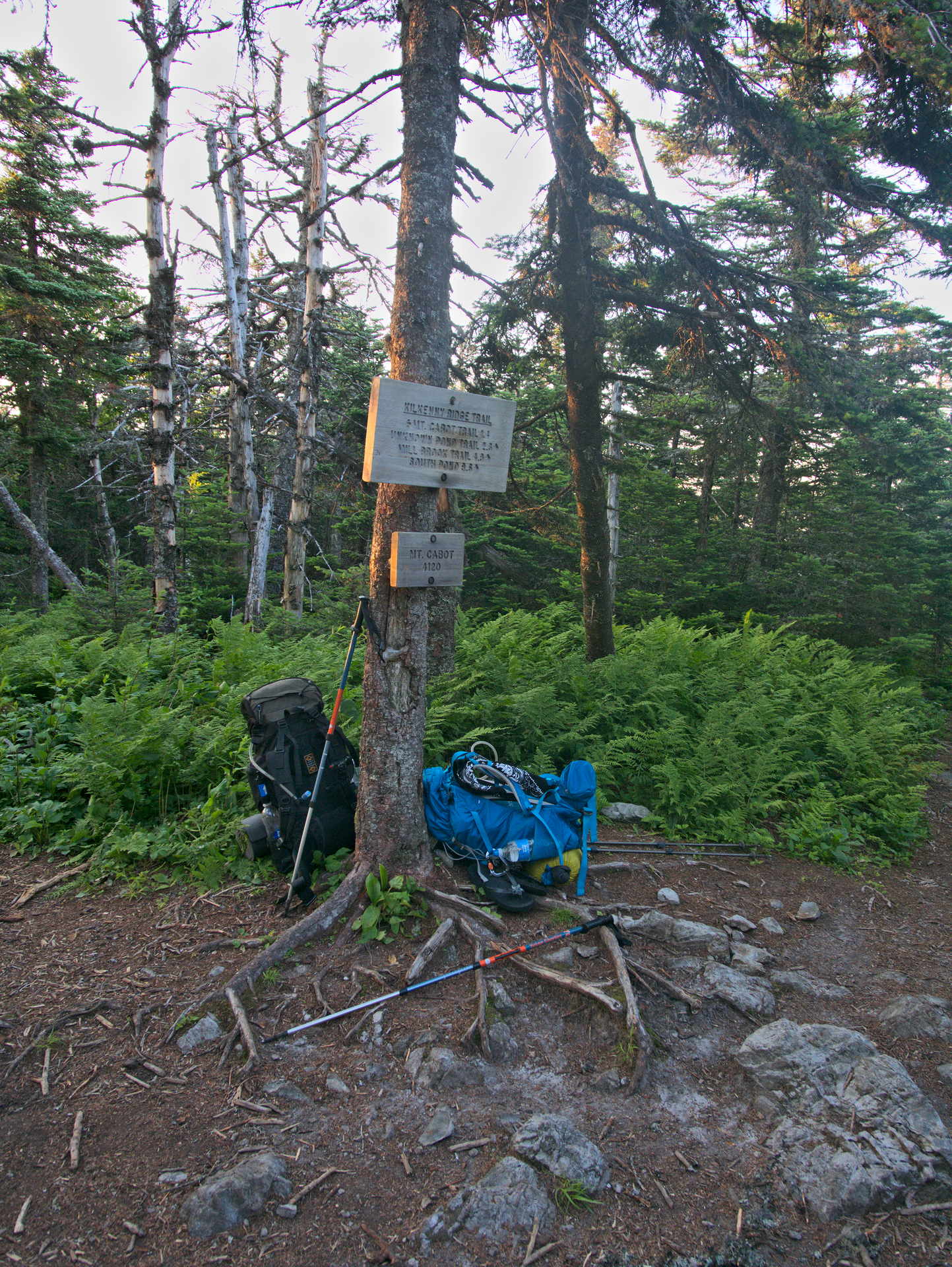
Our spirits lifted a bit in the stretch from Unknown Pond to Cabot which we got to the empty cabin just around sunset. It took us 12 hours. Here is the track for the first day.
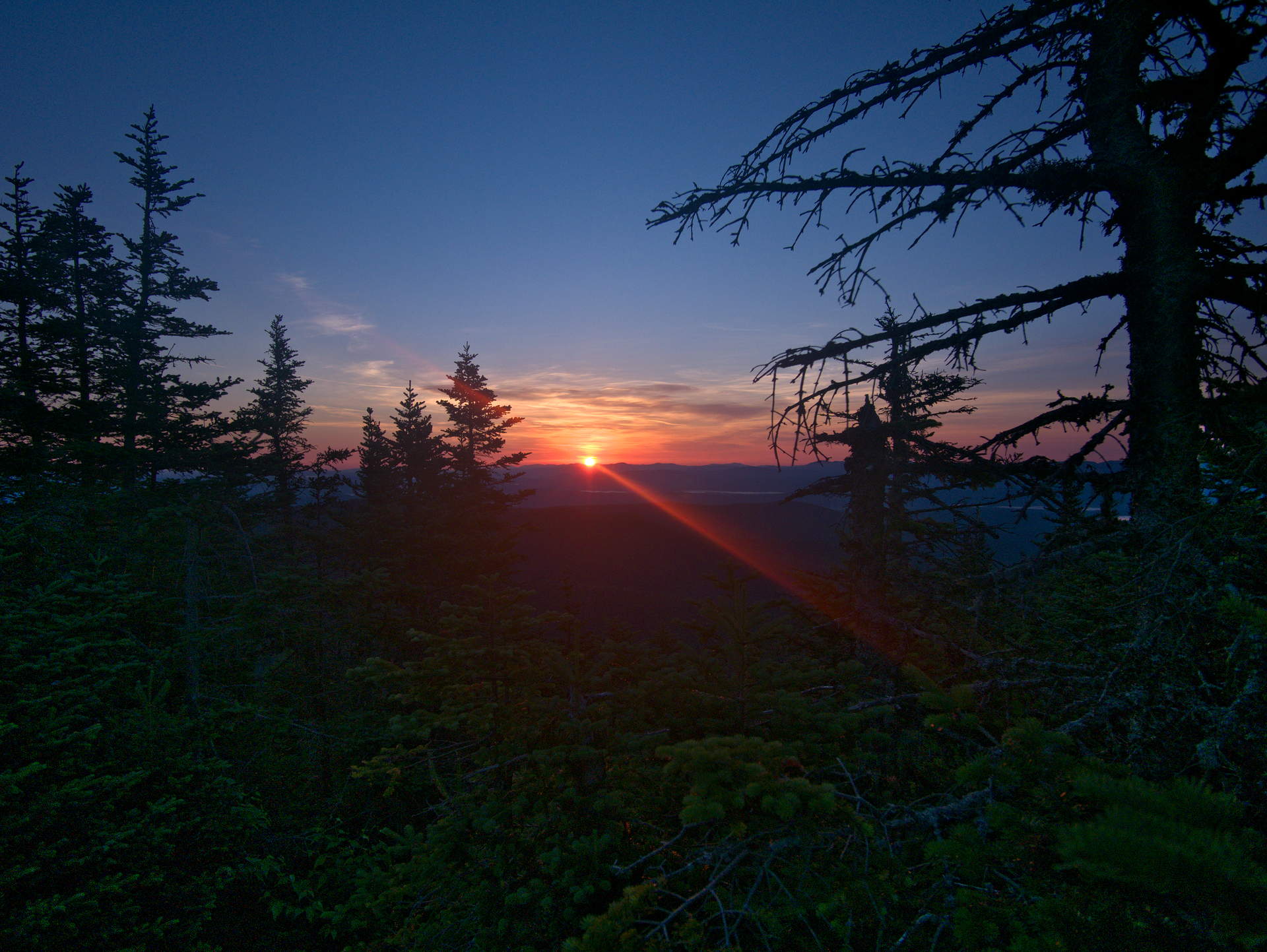
Sunrise the next day around 5. We stayed in the cabin that night which sleeps 8 if every set 2 people want to be cozy on the two sets of bunks inside. It’s also cozy with the woodland critters scurrying in the walls. The cabin was surprisingly warm with the amount of wind we had. Think that the radiant insulation in such a small place is extremely effective. Not sure how to judge wind speeds but it was shaking the cabin gently. Between the mice and the wind there was little sleep to be had, but we needed the rest and it was a blessing to not have to find a place to tent. We “got up” at 4 the next day to decide our next move.
When we were planting the car the first day we met a couple of guys doing the grid that warned us they had encountered a hiker that had to turn back from summiting Waumbek because of an awful blow down situation on it’s ridge and between the Weeks mountains. They mention that he didn’t have a map and the trail was hard to follow which is why he gave up. With the Gaia GPS app, about 55% battery, a map and compass, I figure we could handle navigation. Which was true and probably one of our handful of saving graces to come.
I did deliberate about an out and back quite a bit internally since Roger’s ledge. After all known challenges are safer than unknown ones. However, I knew that if we continued we would still have a route out via York Pond trail. The problem was we would have to climb Weeks Mtn to understand the blow down situation. By that point I figured we might as well just take our time to navigate through them.
There are not many pictures for this part of the trek, for good reason. It just got nested into my bag eventually. Getting to the top of the first Week was tiring in and of it’s self. Terrace Mountain(s) sits between Cabot and Weeks which are both a series of 3 peaks. Terrace was not bad for a morning hiking roller coaster. On the top of the first Week we meet a through hiker doing the Coos Trail. For 11:45 am she looked pretty exhausted, really good spirits though. She explained that the blow downs were “like a war zone” on Waumbek and there was an easier stretch of them between the middle, and last (to us) Week. She also mention she passed a couple of women trying to bag Waumbek. Whom we would meet a little later on. She was pretty natural about the whole situation. Which is probably just, people have to judge their own limits with the information they are given. We had lunch and talked with her some more and moved on.
As it turns out that woman is pretty bad ass because the section of blow downs she mentioned was “easier” knocked us figuratively and literally on our rears. I navigated as much as possible without the phone to save battery life only using it to verify heading. Needed my hands anyhow, it’s hard to describe but sometimes you just couldn’t go over or under these trees that had obviously got hit hard by an unusual easterly wind where the trail was situated to avoid more usual winds from the opposite side. There was one part of the trail that went 90 degrees up because it was part of an uprooted tree. We were pretty consistently getting stabbed by branches and roots not to mention how annoying the flies were. Climbing over, under, and through the downed trees was pretty exhausting and Becca was reaching her limits. When we got to the top of the last Week we ran into the other two hikers. They were a little more tired than the through hiker and less neutral about the turning back concept and were doing so themselves. I’m glad we ran into them, this saved us 2 hours. The showed me on the map where the worst blow down were. They also mentioned that they heard chainsaws in the distance before they turned around.
We moved forward because we hardly had another option at this point. We were likely past our turn around time for going back through the mess we came through to get to York Pond. That and I had an idea to get past what was described as “A nuclear bomb had went off”. If you look closely at our track for the second day you’ll see that we bush whacked on a short stretch before the ridge line. The switchback we avoided was described as a trouble spot. Not that the bushwhack was a cake walk, Becca fell over on one part and had to be sorted out of some branches. She really does have a lot of endurance, was really pushing through at this point. Unfortunately we were about hit the blow downs on the ridge as well according to the other hikers.
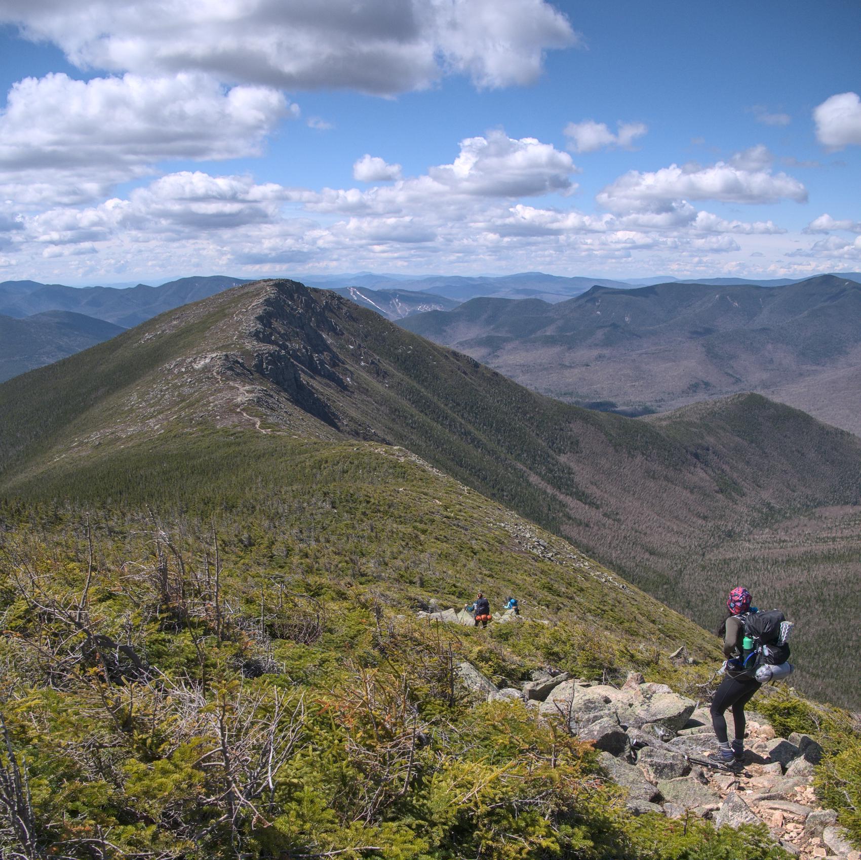
As we reached the crest of the ridge I smelt the amazing smell of sawdust and knew that we had gotten extremely lucky. Barely believed it at first but, A trail crew had at least got to the point where we reconvened with the trail and cleared all the blow downs on the ridge line. It was at this point I knew we were going to get back at a some what reasonable time.
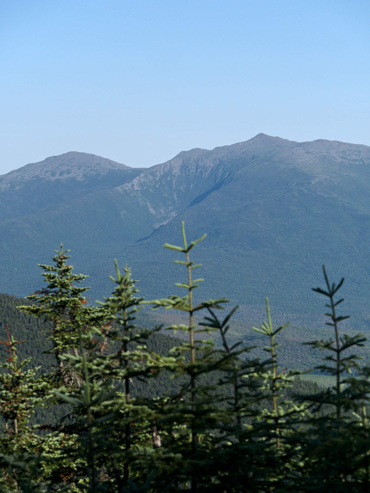
Was time to get my camera back out and take in another moment and reminder of another trying hike. Looking towards King Ravine from this angle I’m not sure I would have ever done it had I realized the rate of vertical incline. King Ravine in that mountain sized gash between Mount Madison on the left and Mount Adams on the right. Believe it or not there is a trail that goes right up the inside of the headwall (Think it’s to the left). I wasn’t exactly sure what that word meant before last year’s ravine hike. It’s pretty clear what it means from this angle. If you look closely you should also be able to make out the Madison Spring hut.
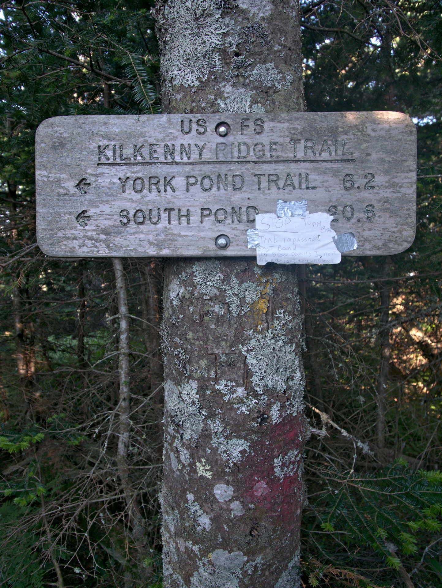
The sign pointing in the direction we came from.. Just to be clear. The note says “Stop turn back, trail impassable 115 blow downs”. Not sure I would have counted them but sounds about right pre clearing. We passed many cleared blow downs on the ridge.
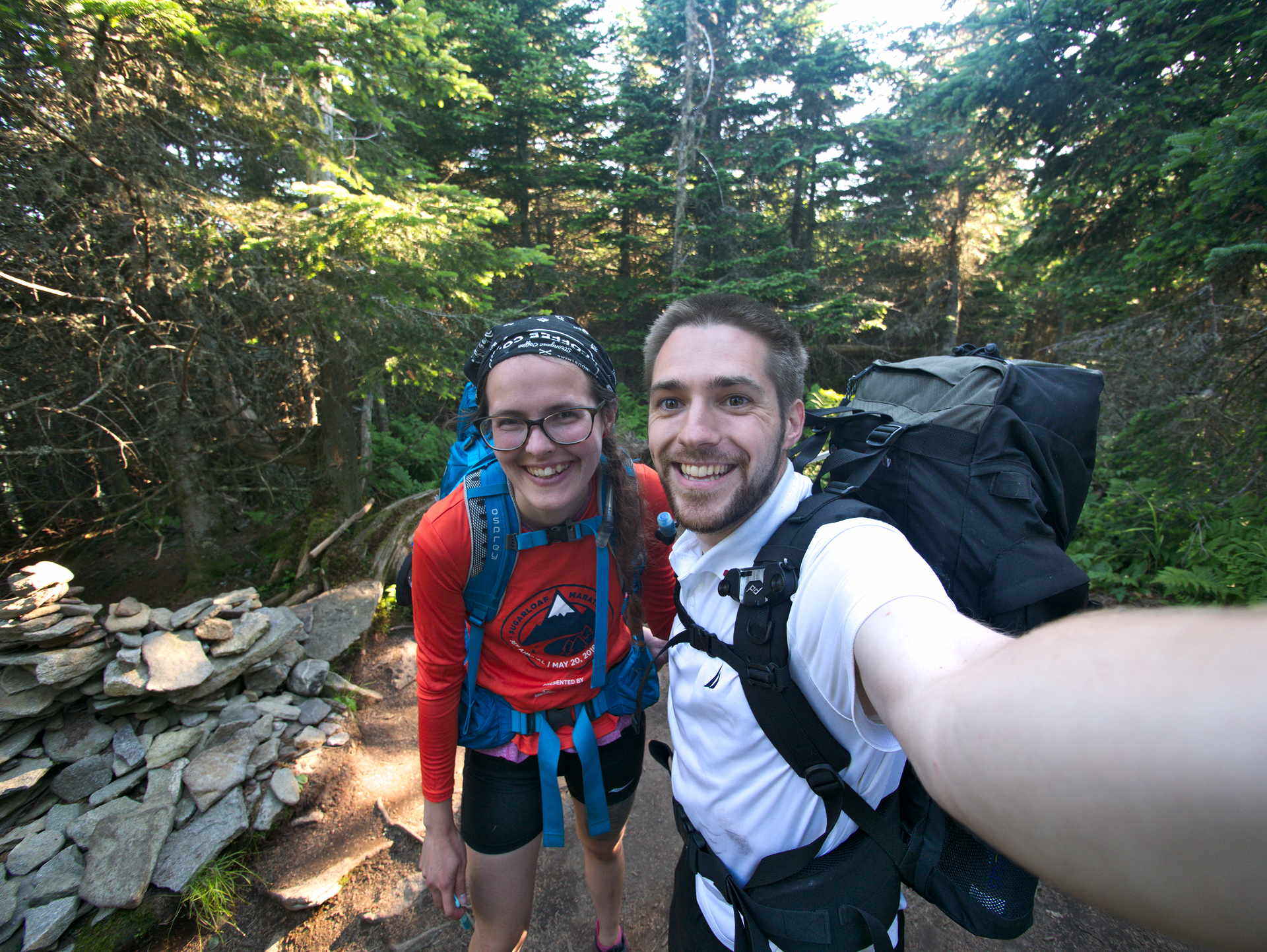
We were in pretty good spirits once we got to the top of Waumbek.
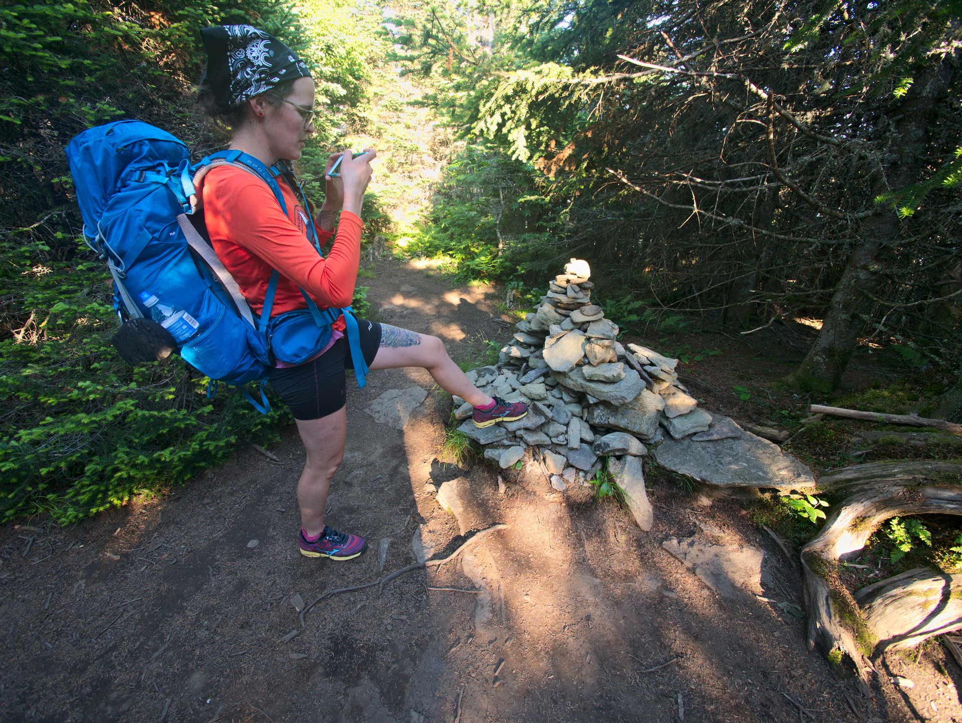
Our fellow hikers we ran into on the last Week asked us if there was a clearly marked summit for Waumbek. Unfortunately I think they missed it, there is a clear Cairn. I think they made the right decision to turn around though. They might have been close but like mentioned before everyone has to be realistic about their limits.
From here we had dinner and it still took about just under 3 hours to get back down and 4 hours to get back in the car. That was a long day.